


The Carolinas and Virginia Brace for Impact: Jan 30–Feb 1 Winter Storm Explained
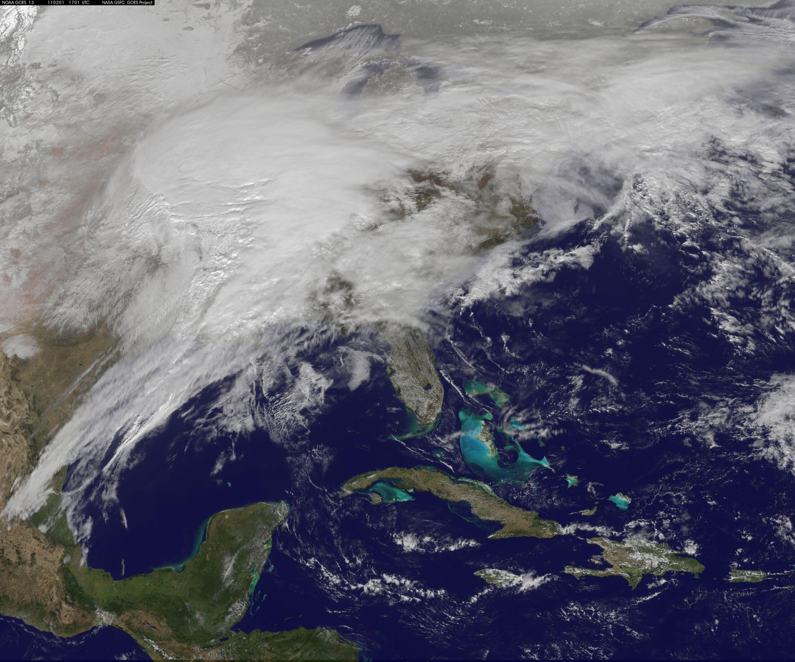
As January draws to a close, residents across the Carolinas and Virginia find themselves looking skyward with a mix of anticipation and apprehension. Meteorological models have aligned to predict a significant winter weather event spanning from January 30 to February 1. For a region that is often more accustomed to mild winters than arctic blasts, this forecast brings a distinct set of challenges.
The National Weather Service and local authorities have begun issuing alerts, urging citizens to prepare for a complex mixture of snow, sleet, and freezing rain. This isn’t just a light dusting; the atmospheric setup suggests a potent system capable of disrupting travel, closing schools, and potentially causing widespread power outages. The timeframe of late January into early February is historically a peak period for Southern winter storms, and this system appears to be following that disruptive tradition.
Understanding the nuances of the forecast is critical for safety and preparation. The difference between a rain event and a crippling ice storm often comes down to a few degrees in temperature and a shift in the storm track of fifty miles. This guide breaks down exactly what to expect, how to interpret the warnings, and the steps you need to take to ensure your household is ready for the Jan 30–Feb 1 winter storm.
What Is a Winter Storm Warning?
When meteorologists and news anchors start throwing around terms like “watch,” “warning,” and “advisory,” it can be confusing to know exactly how to react. However, understanding the specific terminology used by the National Weather Service is the first step in effective preparation.
Definition vs. Watch vs. Advisory
The distinction between these alerts lies in the timing and the confidence level of the forecast. A Winter Storm Watch indicates that severe winter weather—such as heavy snow, heavy sleet, or significant ice accumulations—is possible. It generally means the potential exists, but the timing or specific location is still uncertain. It is a signal to start preparing.
A Winter Storm Advisory usually indicates that winter weather conditions are expected to cause significant inconveniences and may be hazardous. However, these conditions are typically not expected to be life-threatening if caution is exercised.
In contrast, a Winter Storm Warning means that heavy snow, sleet, or freezing rain is occurring or will occur shortly. It indicates that the weather service has high confidence that the event will happen and that it poses a threat to life or property. When you hear “winter storm warning meaning,” translate that in your mind to: “Action is required immediately.”
Why Warnings Signal High Confidence
A warning is not issued lightly. It requires a convergence of data from multiple weather models showing consistent results regarding moisture availability and cold air damming. When a warning goes live, it means the meteorologists are seeing a setup that will almost certainly result in significant impacts to the designated area.
What Thresholds Typically Trigger Warnings
The criteria for these warnings vary by region. In the Carolinas and Virginia, the threshold is lower than it might be in New England or the Midwest. Typically, a warning might be triggered by a forecast of:
- 2 to 4 inches of snow or more within a 12 to 24-hour period.
- Any significant accumulation of freezing rain (often 0.25 inches or more).
- Heavy sleet accumulation that makes travel impossible.
Understanding the difference in a winter storm watch vs warning helps you gauge the urgency of your preparations. If you are under a warning, the time for planning has passed, and the time for implementation is now.
Areas Expected to Be Impacted
The geography of the Carolinas and Virginia makes predicting winter weather notoriously difficult. The mountains, the Piedmont (foothills), and the coastal plains all interact with cold air and moisture differently, creating distinct risk zones.
North and South Carolina Risk Zones
For the upcoming Carolinas winter storm, the risk zones are heavily defined by the “fall line”—the geological boundary between the Piedmont and the Coastal Plain. Areas north and west of the I-85 corridor often see the highest accumulation of frozen precipitation. The mountains of western North Carolina and the Upstate of South Carolina generally have the cold air necessary for snow.
However, the Piedmont regions—including Charlotte, the Triad, and the Triangle—are often the battleground for mixed precipitation. This is where warm air aloft tries to override cold air trapped at the surface, leading to ice storms. South Carolina’s midlands and coastal areas are more likely to see cold rain, though a shift in the storm track could bring freezing rain further south than expected.
Virginia Regions Under Warning
Virginia often faces the brunt of these systems as the cold air is more entrenched further north. The Virginia winter storm warning areas typically encompass the Shenandoah Valley and the Blue Ridge Mountains, where snow totals are usually highest. Central Virginia, including Richmond, often faces the same mixed-bag threat as central North Carolina, balancing precariously between rain, sleet, and snow. Northern Virginia is more likely to see significant snow accumulation compared to the southern counties.
Urban vs. Mountain Impacts
The impact of winter weather is felt differently across landscapes. In mountain regions, residents are generally better equipped for snow, and road crews are accustomed to clearing inclines. However, the terrain makes travel inherently more dangerous.
In urban centers like Raleigh, Charlotte, or Richmond, even small amounts of ice can cripple infrastructure. The sheer volume of traffic, combined with drivers who are inexperienced in winter conditions, creates gridlock. Furthermore, urban heat islands can sometimes delay the onset of freezing, creating a deceptive wet surface that rapidly freezes into black ice as the sun sets.
Timeline of the Jan 30–Feb 1 Winter Storm
Timing is everything. Knowing when the precipitation will start and when it will transition from rain to ice or snow allows you to plan your travel and work schedule accordingly.
When Precipitation Begins
The Jan 30 winter storm timeline suggests that precipitation will begin moving into the region from the southwest on the morning of January 30. For many in South Carolina and southern North Carolina, this may initially begin as cold rain. As the day progresses and the sun sets, temperatures are expected to drop, facilitating the transition to freezing rain and sleet in the identified warning zones.
Peak Impact Periods
The most hazardous conditions are expected overnight on January 30 and throughout the day on January 31. This is when the cold air damming—a wedge of high pressure pushing cold air down the eastern side of the Appalachians—will be strongest. During this window, the heaviest precipitation will fall. If the atmosphere supports freezing rain, this 24-hour period is when power lines will be most vulnerable.
Expected End Time and Lingering Effects
By the morning of February 1, the main system is expected to move off the coast. However, the Feb 1 winter weather forecast does not promise an immediate thaw. Temperatures often remain low on the backside of these storms. This means that whatever falls—be it snow or slush—will likely freeze solid overnight, creating hazardous travel conditions that persist well into February 2 or 3.
Snow, Ice, and Mixed Precipitation Explained
To the uninitiated, “frozen precipitation” might just sound like snow. But in the South, the specific type of precipitation matters immensely for safety and infrastructure.
Snow Accumulation Possibilities
Snow occurs when the entire column of air from the clouds to the ground is below freezing. It is the most scenic and, generally, the easiest to manage of the winter threats. While it affects travel, it offers traction that ice does not. The current snow and ice forecast Carolinas indicates the highest snow totals will be confined to higher elevations and the northernmost parts of Virginia.
Ice and Freezing Rain Risks
Freezing rain is the most dangerous element of this forecast. This happens when snow falls into a warm layer of air, melts into rain, and then falls into a shallow layer of sub-freezing air near the ground. It creates a glaze of ice on every surface. Freezing rain Virginia and North Carolina forecasts are particularly concerning because even a quarter-inch of ice adds massive weight to trees and power lines, leading to widespread utility failures.
Why Mixed Precipitation is Dangerous
Sleet (frozen raindrops) and mixed precipitation create a unique hazard. Sleet accumulates like sand, making roads incredibly slippery and difficult to plow. When sleet mixes with freezing rain, it creates a heavy, concrete-like sludge on roadways that is very difficult to remove. This mix is deceptive; it may look like slush but offers zero traction for vehicles.
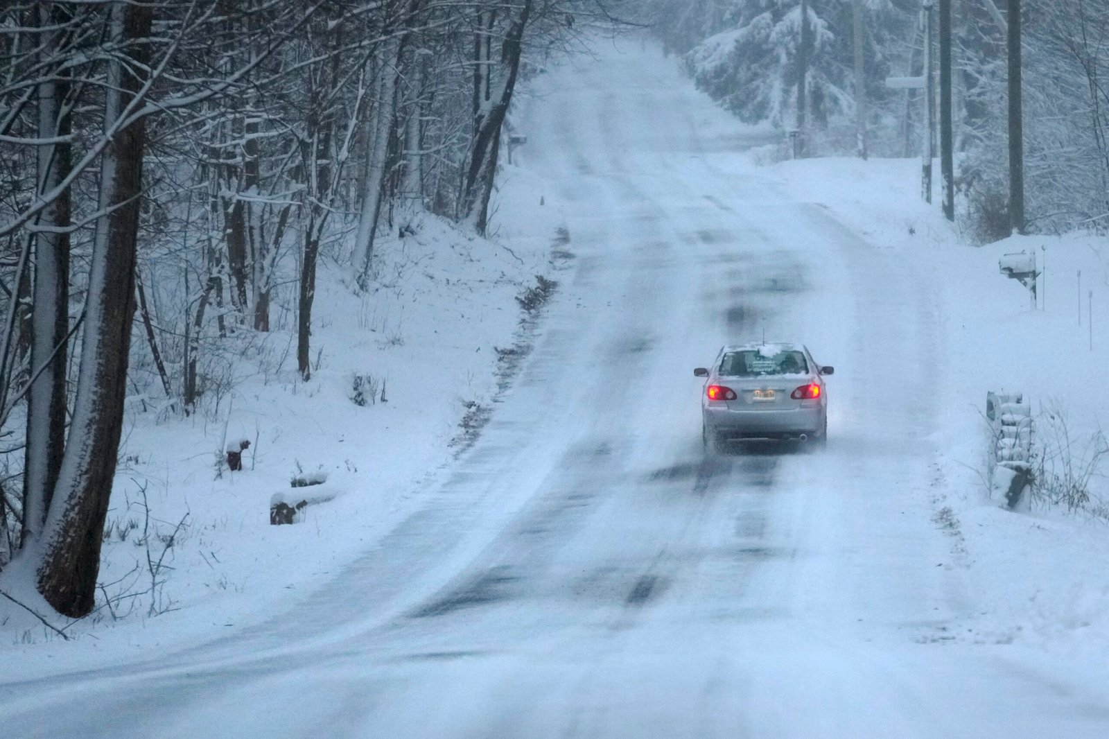
Travel and Transportation Impacts
If history is any indicator, the winter storm travel impacts for this event will be significant. The safest course of action is to stay off the roads entirely, but for those who cannot, understanding the risks is vital.
Road Conditions and Black Ice
The primary threat is icy roads Carolinas and Virginia wide. Bridges and overpasses freeze first because cold air circulates both above and below the road surface. Even if main interstates are treated with brine, secondary roads can remain treacherous for days. The phenomenon of “black ice”—a thin, transparent layer of ice that blends in with the pavement—is the leading cause of winter accidents in the region.
Flight Delays and Cancellations
Major hubs like Charlotte Douglas International (CLT), Raleigh-Durham (RDU), and Richmond International (RIC) will likely experience significant disruptions. De-icing planes takes time, and improved runway conditions do not matter if flight crews cannot get to the airport. Travelers should anticipate cascading delays that could affect flights across the country.
School and Office Closures
School districts in the warning areas are likely to err on the side of caution. Because school bus fleets in the South are not typically equipped with chains or heavy-duty snow tires, closures are standard even for minor accumulations. Offices and businesses often follow suit to keep employees off the roads.
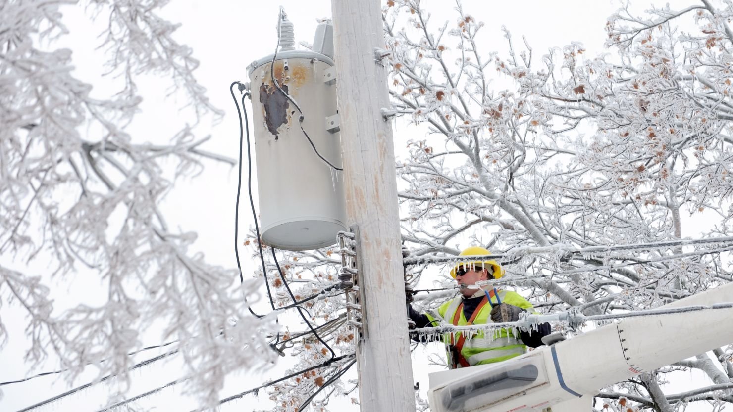
Power Outages and Infrastructure Concerns
Perhaps the most dreaded aspect of a Southern winter storm is the loss of electricity. The winter storm power outages associated with ice events can leave residents without heat for days.
Ice Load on Power Lines
Ice is heavy. A half-inch accumulation of ice on power lines can add 500 pounds of extra weight to the span of the line. When you combine this weight with wind gusts that often accompany winter storms, the stress on the infrastructure becomes unsustainable, causing lines to snap.
Tree Damage Risks
Often, it is not the lines themselves that fail, but the trees around them. The region is heavily forested with pine trees, which hold their needles year-round. These needles catch ice, weighing down branches until they snap and fall onto power lines or homes. Ice storm infrastructure damage is frequently caused by falling vegetation.
How Long Outages Could Last
Restoration times depend on road conditions. If utility trucks cannot navigate icy roads, they cannot repair the lines. In severe ice events, outages can last from a few days to over a week.
How This Storm Compares to Past Winter Events
Context is helpful when gauging how to react. Looking at Carolinas winter storm history helps residents understand the potential severity.
Historical Context for the Region
The South has a history of “surprise” storms where a shift in temperature turned rain into a catastrophic ice event. The geography of the region, specifically the “damming” effect of the Appalachians, traps cold air in a way that models sometimes struggle to predict perfectly.
Why Southern Winter Storms Are Disruptive
Unlike the Northeast, which has massive fleets of snowplows and salt trucks, Southern states have fewer resources because these events are rare. Furthermore, the soil in the South is often unfrozen, meaning snow and ice can melt from the bottom and refreeze, creating complex layers of ice that are difficult to scrape away.
Lessons from Previous Storms
Past Virginia ice storms and Carolina snow events have taught residents that over-preparation is better than being caught unaware. The primary lesson is that conditions deteriorate faster than expected. Roads that are passable at 4:00 PM can be parking lots by 5:00 PM.
How to Prepare Before the Storm Hits
Preparation is the key to weathering the storm comfortably. Use this winter storm preparation tips checklist to ensure you are ready before the first flake falls.
Home Preparation Checklist
- Heating: Ensure you have a safe, backup heating source. If you have a fireplace, have dry wood ready.
- Water: If you rely on a well, an electric pump won’t work without power. Fill bathtubs with water for flushing toilets and stock up on bottled water for drinking.
- Food: Stock non-perishable food that doesn’t require cooking.
- Charging: Charge all phones, laptops, and external battery banks.
Vehicle and Travel Readiness
- Fuel: Keep your gas tank full. This prevents the fuel line from freezing and allows you to use the car for heat (in a well-ventilated area) in an emergency.
- Wipers: Lift your windshield wipers off the glass to prevent them from freezing to the windshield.
Emergency Kits and Supplies
A solid storm readiness checklist includes flashlights with extra batteries, a first-aid kit, prescription medications, and plenty of blankets. Don’t forget needs for pets and infants.
Safety Tips During the Storm
Once the storm begins, the focus shifts to safety. Following winter storm safety tips can prevent injury and death.
Staying Off Roads
The best way to stay safe is to stay home. If you do not absolutely have to drive, don’t. Emergency responders will already be stretched thin; do not add to their burden by becoming a stranded motorist.
Preventing Hypothermia
If the power goes out, dress in layers. Wear a hat, as a significant amount of body heat is lost through the head. Close off unused rooms to conserve heat in a central living area.
Safe Heating Practices
Cold weather safety includes proper ventilation. Never use a gas stove or oven to heat your home. Never run a generator indoors or in a garage. Carbon monoxide is odorless, colorless, and deadly. Ensure your CO detectors have fresh batteries.
What to Do After the Storm
The danger doesn’t end when the precipitation stops. Post winter storm safety is just as crucial.
Checking for Ice Damage
Walk around your property (carefully) to check for downed lines or damaged trees. Stay far away from any downed utility lines and assume they are live.
Safe Snow and Ice Removal
Shoveling snow is a rigorous cardiovascular workout. Cold air constricts blood vessels, increasing the risk of heart attacks. Take frequent breaks and lift small loads. When dealing with after ice storm cleanup, be wary of falling ice from rooflines and gutters.
When to Resume Travel
Wait until local authorities give the all-clear. Just because the sun is out doesn’t mean the black ice has melted.
Frequently Asked Questions (FAQ)
How much snow and ice are expected in the Carolinas and Virginia?
Accumulation will vary wildly by location. Northern Virginia and the mountains could see 4–8 inches of snow. The Piedmont regions of NC and VA are more likely to see a mix, with potential ice accretion ranging from a glaze to 0.25 inches. Always check your local county forecast for precise numbers.
Should residents expect power outages?
Yes. If you live in an area forecasted to receive freezing rain or heavy wet snow, the risk of power outages is moderate to high. Residents should prepare to be without power for at least 48 hours.
Is this storm dangerous for travel?
Extremely. The combination of mixed precipitation and freezing overnight temperatures will likely make roads impassable. Travel is strongly discouraged from the evening of Jan 30 through the morning of Feb 2.
How long will the winter storm last?
The precipitation event is expected to last roughly 36 to 48 hours, ending on February 1. However, sub-freezing temperatures may keep ice on the ground for several days following the storm.
What supplies should households prepare?
Essentials include: 3 days of non-perishable food and water, flashlights, batteries, first aid supplies, necessary medications, baby supplies, pet food, and a battery-powered weather radio.
Final Thoughts — Stay Informed and Prepared
The Jan 30–Feb 1 winter storm warning is a serious weather event for the Carolinas and Virginia, but it is manageable with the right mindset. By monitoring local alerts, respecting the power of winter weather, and preparing your home and vehicle now, you can reduce the risk and stress associated with the storm.
Safety comes first. Enjoy the beauty of the winter landscape from the warmth and safety of your home, and look out for your neighbors as the region weathers this storm together.